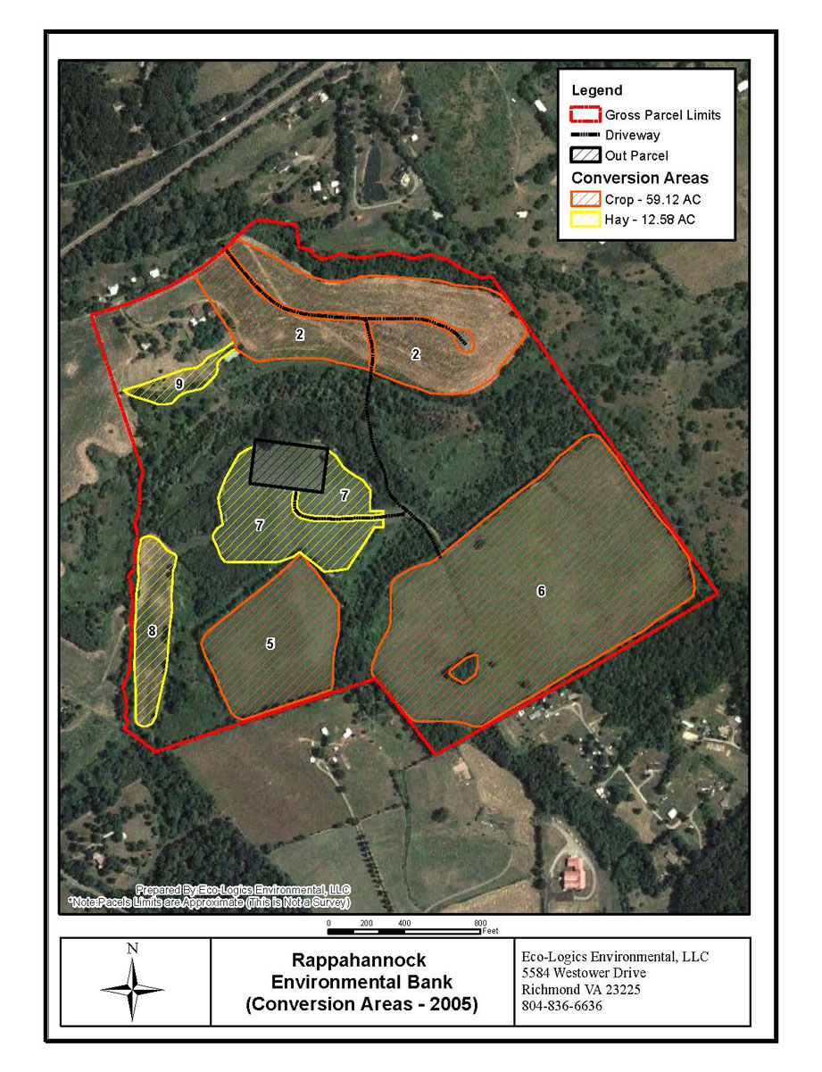
Location: Orange County, Virginia
Project Size: 71.71 acres
Credits: 81.8 P, 260.93 N
The approximately 139-acre parcel is located on the south side of Old Barboursville Road .9 miles east of the intersection of US Route 20 and US Route 33 in Barboursville, VA. At the foot of the Southwest Mountain range and Cowherd Mountain, elevations range from 496’ on the hilltops to 428’ in the stream valleys. It is surrounded by cropland to the south, east, and west and a large-lot residential development to the north (on the opposite side of Old Barboursville Road.) In the western Piedmont physiographic province, the property has historically been used for agricultural and silvicultural practices. The property is moderately sloping with approximately 87 acres in agricultural production and the balance in forest and wetlands. The property includes Blue Run, a perennial tributary, and an unnamed, perennial stream. Both are tributaries of the Rapidan River near the confluence with the Rappahannock River.